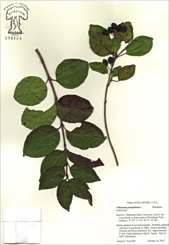
Viburnum prunifolium
Viburnum prunifolium
BLACKHAW
Adoxaceae
E. North America
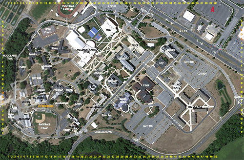
Location: map coordinates I-3 (on Loop Road, in front of Woodland Trail entrance), N 39°11'14'' W 75°32'48''
Planting history: probably planted with new Loop Road ca 2000. Source probably (Terrain at) Styers (nursery), PA.
Description:
Native species, State Rank S5 (very common in Delaware)
BLACKHAW
Adoxaceae
E. North America
Location: map coordinates I-3 (on Loop Road, in front of Woodland Trail entrance), N 39°11'14'' W 75°32'48''
Planting history: probably planted with new Loop Road ca 2000. Source probably (Terrain at) Styers (nursery), PA.
Description:
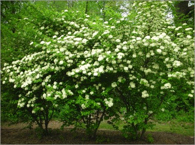
- deciduous shrub
- etymology: Viburnum from the Latin name for V. lantana; prunifolium = plum leaf (for the leaf shape)
- common name “blackhaw” for the blue-black fruits
- until recently, placed in honeysuckle family (Caprifoliaceae)
- leaves opposite, with small teeth
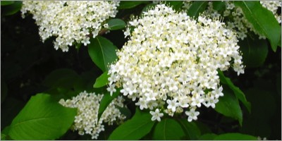
- flowers small, white; in showy clusters (cymes)
- fruits small, blue-black, drupes (stone fruits), in clusters; food for birds and other wildlife
- native habitat rich woods, thickets, woods edges
Native species, State Rank S5 (very common in Delaware)
HIT REFRESH TO START LOCATION GRAPHIC